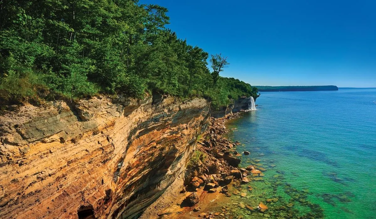
Pictured Rocks National Lakeshore National Park is a scenic reserve located on the south shore of Lake Superior in the upper part of the Michigan peninsula in the United States. The park is famous for its unusual scenery, various rock formations such as natural arches, sand dunes and waterfalls.
Pictured Rocks is named after the 24 km long colorful patchy sandstone cliffs northeast of the town of Munising. The height of the rocks reaches 60 meters above the lake level. Various caves, arches, towers of the castle are naturally formed in these rocks, you can even see various images in them, among which there will even be human profiles.
 |
| Pictured Rocks National Lakeshore |
This area extends for 67 km along the coast between the cities of Munising and Grand Marais and covers 296 sq. km. km. Near Munising, tourists can see the beautiful places of Grand Island (Grand Island), some of which are included in the National Recreation Area. In 1966, the US Congress designated Pictured Rocks as a protected lake area and the name of the reserve became Pictured Rocks National Lakeshore, and the National Park Service (NPS) is responsible for the prosperity of the reserve.
The rocks are a composition of the Munising Formation, which appeared 500 million years ago, during the Cambrian sandstone period. The formation sits atop the Precambrian red Jacobsville Formation, the oldest formation in the park. At the top of the Munising Formation is the young Ordovician Au Train Formation.
Such unusual colors of lake rocks are obtained due to the content of a large number of various minerals and metals in them. So, red blotches are obtained due to iron, black and white shades due to manganese, and yellow-brown - copper, etc. You can also see stripes of red, yellow or red color on the rocks, they arose due to the action of underwater waters that flow from the walls of these rocks seeping through the sandstone.
Michigan's Pictured Rocks Park is full of numerous and varied waterfalls, among them the famous 15 meter Munising Falls, which collapses over a sandstone cliff, the same largest Miners Falls, Bridalveil Falls, which is gaining strength during the rainy season and snowmelt, and on hot summer days it almost dries up, you can also look at the beautiful waterfall Mosquito Falls (Mosquito Falls) with a height of 2.4 meters, river otters and beavers are found here, it is also worth visiting Spray Falls (Spray Falls), which falls 23 m over several cliffs of sand formations and Chapel Falls (Chapel Falls) with clear mountain waters and cascades extending 18 meters.
Walking through the Pictured Rocks park. In order to drive from one end of the lake to the other, you need to use the H-58 highway, but the roads approach the coastline only near Miners Castle, 12 Mile Beach and the Grand Sable Dunes. The rest of the coastline is only accessible for hiking. The 67-kilometer section of the northern tourist route runs along the shore of the lake. Camping is allowed only in designated areas.
Also for excursions along the coast, many boat companies offer their services and provide boats or boats. Kayaking is another popular form of exploring the park and is probably the best way to explore all parts of the shore and see the natural formations, but it takes skill not to roll over and get wet in the lake's cold waters. During the winter season, Pictured Rocks offers recreational sports such as cross-country skiing, snowshoeing, snowmobiling and ice fishing.
Each year, the Pictured Rocks National Lakeshore National Park is becoming more and more popular among tourist destinations, as in 2015 there was a 37 percent increase in visitors than in the previous year, this is over 720,000 people. Communities near Lake Superior National are doing their best to cope with the wave of tourists, as such a boom in visitors has even caused some problems with parking, lack of toilets and hotel rooms.
