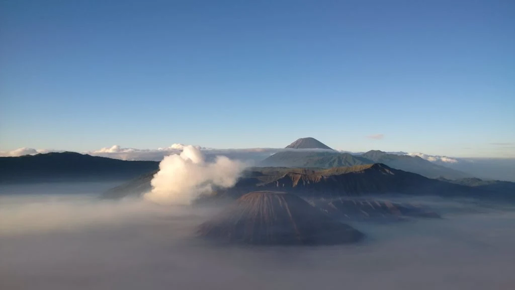
Bromo Tengger Semeru National Park, East Java, Indonesia. The national park is named after its two mountains, Mount Semeru (the highest in Java) and Mount Bromo (the most popular), and Tengger of the people who live here.
 |
| Bromo Tengger Semeru National Park |
The most famous and beautiful mountain scenery in East Java. Bromo Tengger Semeru National Park.
Some Indonesians believe that volcanoes such as Mount Semeru (in the background) and Mount Bromo (in the foreground) are entrances to the underworld that shape not only the Indonesian landscape, but also beliefs and culture.
 |
| Bromo Tengger Semeru National Park |
Mount Bromo is the most visited part of the National Park by tourists. The entire top of Mount Bromo (altitude 2329 m above sea level) is destroyed by a volcanic eruption, and its crater continues to periodically emit vapors of white sulfuric smoke. The mountain is located inside the massive Tengger caldera with a maximum width of 10 km. Usually Mount Bromo is visited from the neighboring village of Cemoro Lawang. It takes about 45 minutes to walk from this village to the volcano. But first (at dawn) the mountain is viewed from the observation platform of Mount Penanjakan, and only then they descend to the bottom of the caldera to the volcano itself. The Bromo crater is 600 meters in diameter, the volcano has been in a state of constant activity for the past 20 years, its crater is filled with smoke from active fumaroles. Two tourists died in the 2004 eruption. Eruptions were noted in 2010 and 2011.
On the territory of the park there is the highest peak of the island of Java - Mount Semeru with a height of 3676 m. Climbing to its peak takes two days, does not require special skills and equipment, but is designed for physically strong people.
 |
| Bromo Tengger Semeru National Park |
The mountainous area of the park is inhabited by the Tenggers, the Hindu community of the island, who moved here in the second half of the 19th century. In total, about 600,000 tengers live in the mountainous region.
The national park is located in the center of East Java. The territory received the status of a national park on October 14, 1982. Photo by Achmad Sumawijaya.
