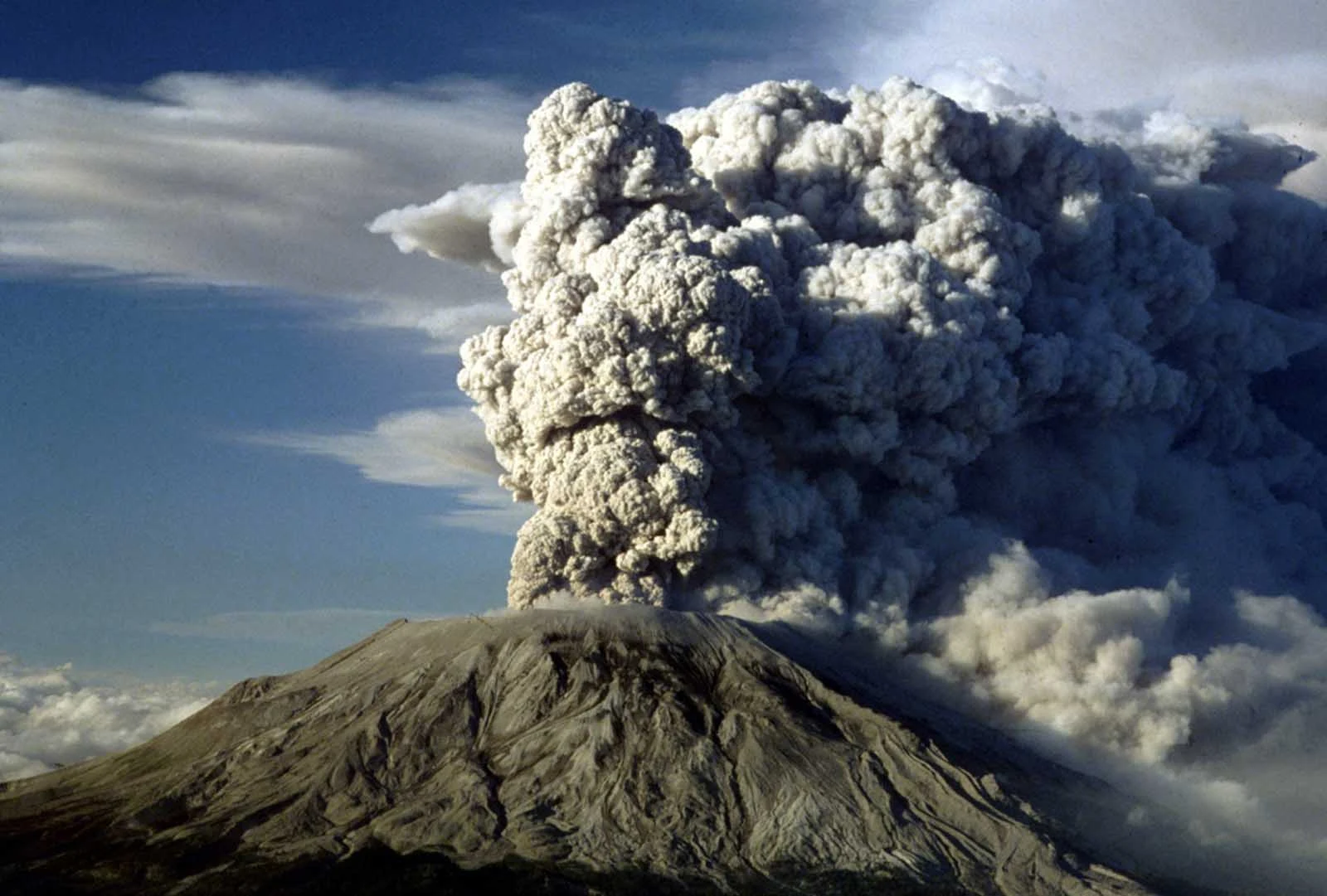
Mount St. Helens is located in Skamania County, Washington state (USA), and is one of the world's active stratovolcanoes. Its location in Skamania County puts it 50 miles northeast of Portland, and 96 miles south of Seattle. This volcano is part of the Cascade Range, and during the current Holocene period, it has been the most active. In addition to being the most active, scientists predict that it is the most likely to erupt of all the volcanoes found in the United States. The volcano has an elevation of 8,363 feet, and contains a horseshoe-shaped crater that developed during its most famous eruption, in 1980.
 |
| Mount St Helens |
History
Mount St. Helens has been active for about 275,000 years, during which time it has experienced all kinds of volcanic activity, ranging from quiet lava outpourings to explosive and violent eruptions. During the last few thousand years, Mount St. Helens finally reached the height of 8,363 meters (previously it was 9,677 feet), which made it the fifth highest peak in Washington. It reached its current height after the eruption in 1980, due to an avalanche.
Volcanologists have divided the volcano's activity into four stages: Ape Canyon (35,000 years ago), Puma (18,000 years ago), Swift Creek (12,800 years ago), and Spirit Lake (3,900 years ago - present). Because each stage changes the composition of the volcano, destroying evidence of earlier stages in the process, more is known about the newer stages than the older ones.
 |
| Mount St Helens |
Semi-recent eruptive periods. The Sugar Bowl Eruptive Period, took place between 850 and 900, and during this time, three lava domes developed on the flanks of Mount St. Helens. Despite these additions, there was no significant change to the appearance of the volcano during this period.
The Kalama eruptive period took place between 1479 and 1720, and this period is when Mount St. Helens reached its pre-1980 height, around 1,600 feet of elevation were added to the volcano during this period. At the beginning of this period there were two large and explosive eruptions that took place in the years 1479 and 1482. The first part of this period also produced many pyroclastic flows and lahars. The middle phase began around 1510 and during that time there were few lava flows, but many pyroclastic flows. The Summit Dome grew during the last phase of the Kalama period on Mount St. Helens and most likely took about 100 years to create.
Another eruptive period on Mount St. Helens took place from 1800 to 1857, and that is when Floating Island, a lava flow, was created in 1801. Scientists believe that the last significant eruption during this period (and, of fact, until 1980) was carried out in 1857, although there were minor explosions in 1898, 1903 and 1921.
 |
| Mount St Helens |
1980 eruption. The Mount St. Helens eruption in 1980 is probably the best known of this volcano. The first eruption in this group occurred on March 27 and was the first in more than 100 years. The eruptions continued, once an hour during March and fell to once a day on April 22. The eruptions were stopped until May 7, in which small eruptions occurred until the 17th. Mount St. Helens had suffered more than 10,000 earthquakes, causing the north flank to grow about 250 meters. This bulge was still growing, indicating that a magma pool would erupt in the future.
The aforementioned 5.1 magnitude earthquake occurred on May 18, at which point both the summit and the northern bulge collapsed. This was, in fact, the largest debris avalanche ever recorded in Earth's history, with a total volume of around 3.3 billion cubic meters. The landslide removed the northern flank of Mount St. Helens, which in turn caused a large lateral explosion of hot debris traveling at about 300 kilometers per hour.
Mount St. Helens, future eruptions. Although this volcano is the most likely of the waterfalls to erupt again, experts do not believe it to be as damaging as the 1980 eruption. And a lateral explosion, or a large debris avalanche, is not thought to be. probable. The main risks to the renewed activity at the volcano are lahars, explosive eruptions that cause pyroclastic flows and a continuation of the growth of the lava dome. Since scientists are not able to predict the next eruption very far in advance, they keep a close eye on the volcano with a wide range of geological equipment.
