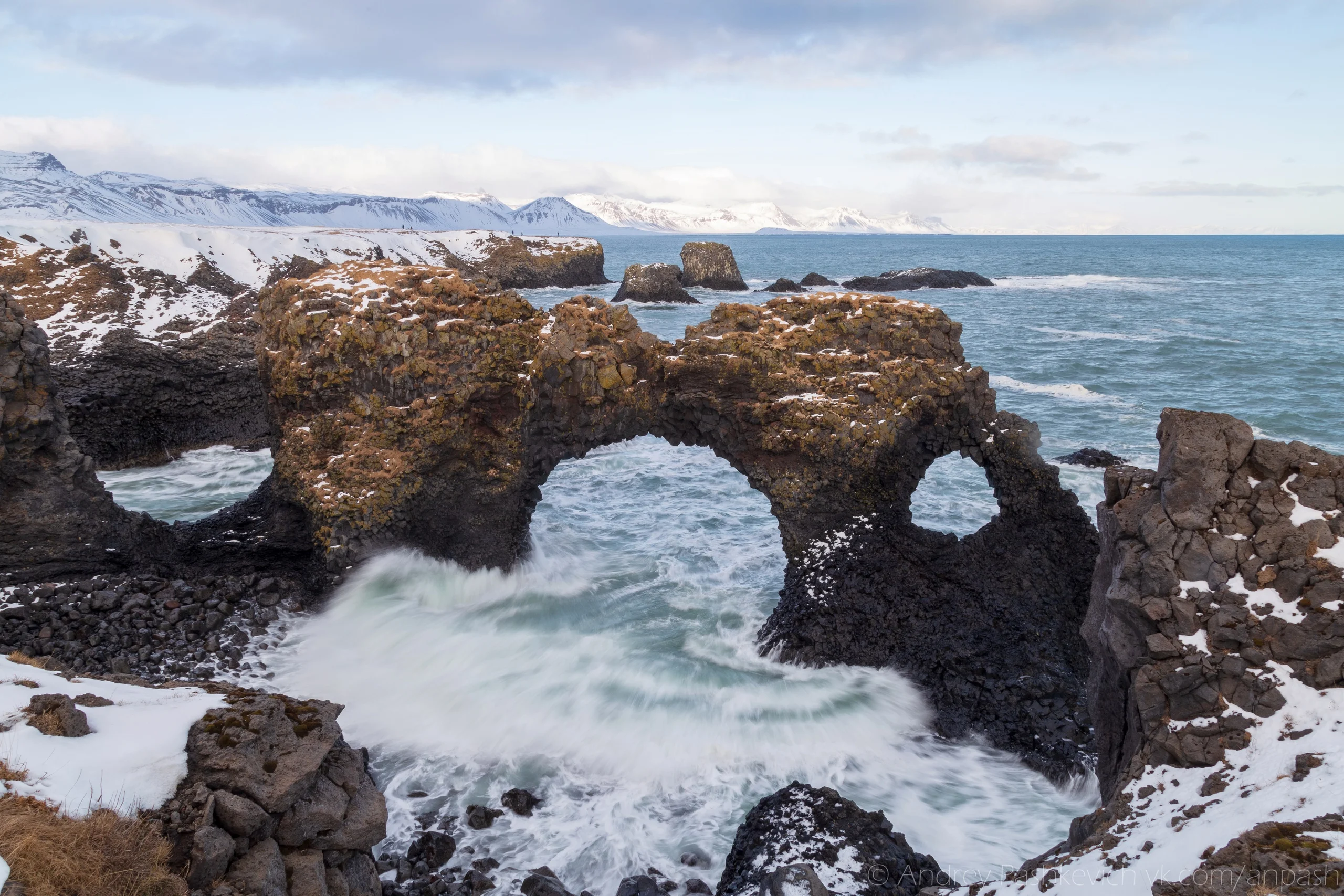
Gatklettur is a famous, naturally formed stone arch found between the villages of Arnarstapi and Hellnar on the Snæfellsnes Peninsula, Iceland.
 |
| Gatklettur Iceland |
The most famous is the ancient Roman triumphal arches, which have been preserved in abundance both in the Eternal City itself and in the vast territories that were part of the empire. However, the Romans were not the first to build them, more ancient Babylonian and Assyrian architectural monuments of this kind are known, located in the interfluve of the Tigris and Euphrates. But it was not the inhabitants of Mesopotamia who came up with such a design, the oldest samples were created by nature, and man only spied on her grandiose plan, which includes Gatklettur.
 |
| Gatklettur Iceland |
It is one of the most striking of Icelandic geological formations, although not as well known as the objects of its kind near the village of Vik, but has become a popular tourist attraction for those looking for something unique and unusual. The stone arch of Gatklettur is located in Western Iceland, on the territory of the historical region of Vesturland, in the southern part of the Snaefellsnes peninsula, next to the fishing village of Arnastapi. Like other coastal geological formations, it is part of the Snaefellsjokull National Park.
 |
| Gatklettur Iceland |
This is, without a doubt, one of the Icelandic natural wonders, which has a pronounced volcanic origin. The creator of the arch was the stratovolcano Snaefellsjökull, located 15 km to the north, after which both the reserve and its glacier are named. But, in fact, he formed only the basalt rock itself, during prehistoric eruptions that occurred 5000-8000 years ago, when flows of molten lava merged directly into the ocean. The rest was done by the ocean waves during the tides and exposure to the sun and wind.
 |
| Gatklettur Iceland |
The basalt arch of Gatklettur is represented by a fragment of a wall that rises on the coast, the northern edge is connected with the coastal rocks, and the southern edge extends into the ocean at a short distance from the coast. Its shape can be called ideal, since it has consistent proportions, without angularity, with smoothly rounded “openings”. It cannot boast of large dimensions, but is not without monumentality, reaching 11.5 m in height, 10.2 of which is occupied by an arched vault located in the center, with a small round “window” on the right side of it.