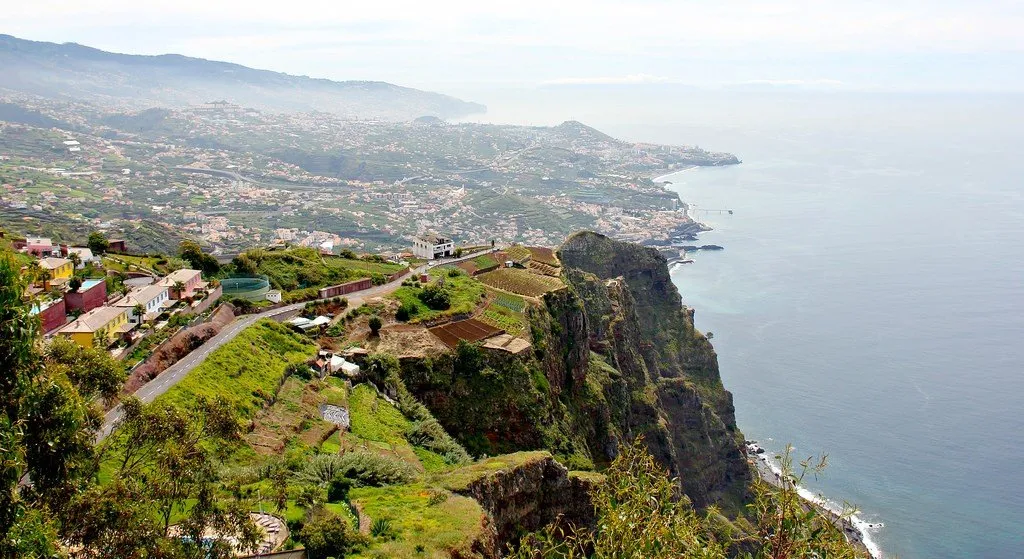
Madeira Island is an archipelago located 520 km off the coast of Africa and 1000 km from Portugal, of which it is an autonomous region. In the past, the largest producer of sugar cane, who switched to the production of the famous fortified wine, in our time, Madeira has become an attractive tourist destination for beach and educational holidays for travelers from all over the world. Mild climate, evergreen forests, sandy beaches, mountain slopes, steep shores - Madeira has everything to be the perfect holiday destination. The archipelago has one minus - remoteness from densely populated continents, but many tourists consider this disadvantage to be a virtue.
 |
| Madeira Island Portugal |
Geographic location and nature
The islands are located in the North Atlantic Ocean, southwest of Portugal. The archipelago includes the largest island of Madeira, which is significantly inferior in size to Porto Santo with adjacent small islands and the Ilyas Desertas archipelago. The uninhabited islands of Selvagens administratively belong to autonomy, but this is a separate archipelago. Madeira is of volcanic origin, the main island is the peak of a volcano protruding from the water, which last erupted more than 6 thousand years ago.
 |
| Madeira Island Portugal |
Climate
The climate of the archipelago is very mild, Mediterranean, the temperature difference between winter and summer is minimal, precipitation falls mainly in the autumn-winter period. Near the islands passes the Gulf Stream and the cold Canary Current, which becomes moderately warm in this area. As a result, there is no heavy heat in Madeira, the water temperature is kept within +18...+22 °C. On the northern coast of the main island it is rainy, on the south it is dry. The islands' peaks are in March-April and July-August.
Madeira Island
The island is a trapezoid with a maximum size of 57 by 27 km. The average height of Madeira is 1300 m above sea level. The largest peak of Pico Ruivo, with a height of 1862 m, is famous as an excellent observation platform. Any physically fit tourist can climb it, but it is not recommended to do this in cloudy weather and fog. The peak is above the line of clouds, and in case of poor visibility, you can miss rare fences and collapse down. There are two ways to climb to the top. Easier is to drive to the village of Ashada do Teixera and overcome the 45-minute route on foot. More picturesque - park on the site near the neighboring Pico do Arieiro with a height of 1818 m, dine at a local restaurant, look into a souvenir shop and go to conquer Pico Ruiva. Part of the journey will pass through a tunnel, so sportswear, comfortable shoes and a flashlight are a must.
 |
| Madeira Island Portugal |
Once the mountainous island was completely covered with evergreen forests, but now, due to the rapid development of agriculture, only 20% of them remain. The surviving unique laurel forests of Madeira, or laurasilva, have been included in the UNESCO World Heritage List since 1999. In the marine reserve of Garajau, in the suburbs of the capital of the autonomy of Funchal, you can observe various types of dolphins, pilot whales, Bride's minke whales, sei whales, fin whales, sperm whales, beaked whales coming close to the coast. 15 km from Funchal there is an unusual natural object - the highest cape in Europe, Cabo Girao, reaching a height of 580 meters.
Another, this time, natural and man-made attraction of the island of Madeira is the levada grooves. Due to the peculiarities of the climate, the southern part of the island needed additional irrigation for agriculture, so narrow channels were dug here from the northern, rainier one. Paths have been built along them - the favorite routes of tourists. The first levadas appeared in Madeira in the 16th century, the last ones 70 years ago. Their total length is 2000 km. One of the most accessible routes is the 7 km long Mimosa Levada, so named because of the plants blooming along its edges. More difficult directions can be dangerous due to the narrowness of the path and the steepness of the cliff.
 |
| Madeira Island Portugal |
Porto Santo Island
The island is located 43 km northeast of Madeira and is 17 times smaller than Madeira. Only 9 km of coastline in the south-west are occupied by white sand beaches, the rest is bare rocks that break into the sea. The climate on the whole island is dry, the chances of getting caught in the rain are only in winter. The mountainous part of Porto Santo consists of peaks about 0.5 km high, 100-200-meter hills are concentrated in the southwest. Even the first settlers recklessly brought rabbits to the island, since then almost nothing has remained of its green cover.
Ilyash Desertash Islands
The archipelago is located between Madeira and the Canary Islands, 25 km from the east coast of the main island. It consists of three high and narrow rocky islets. Ilyash-Dezertash is a reserve in which various species of birds, rabbits, an endemic wolf spider, goats and rodents live, a special permit is required to visit it. Fresh water is available only on the Big Island; monk seals have also set up a rookery there.
