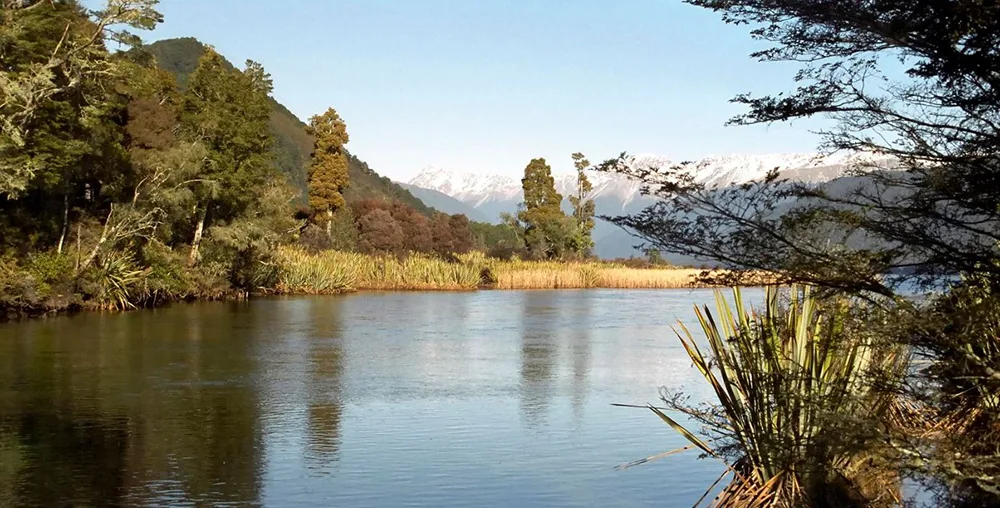
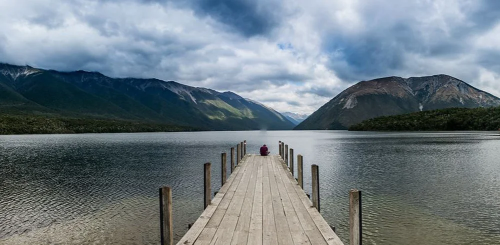
Nelson Lakes National Park is a mountainous area in the southern part of the Tasman region, centered around large and small lakes: Anjdelus, Constance, Hanapori Tarn. There are even some that don't have names. But the biggest, most popular and most famous of them all are Lake Rotoroa and Lake Rotoiti. The territory of the park is almost completely deserted. There are no cities or even small villages. The only settlements in the park are two very tiny villages on the northern shores of lakes Rotoiti and Rotoroa. But at the same time, the territory of the park is very large, 1020 square kilometers, and this makes the Nelson Lakes National Park one of the largest national parks in New Zealand. It borders the regions of Canterbury and Marlborough, and from the south is the administrative boundary of the West Coast region.
Lake Rotoroa
The largest lake in the Nelson Lakes National Park is Rotoroa. It is fed by the rivers d "Urville and Sabine. These rivers flow into the lake from the south, and in the north the tributary of the Buller River, the Govan River, flows out of the lake. Lake Rotoroa is quite deep - 145 meters in the deepest place. On all sides, Lake Rotoroa is surrounded by a beech forest and the lake itself has a lot of trout.Although fishing in New Zealand is not as easy as it is here, you need to purchase a license.In addition, the use of jet boats and water skiing is prohibited on the lake.There is a fishing lodge on the shore of the lake, built back in the twenties of the twentieth century, and in the northern part, at the source of the Govan River, a tiny village of Rotoroa, a dozen houses and several small streets surrounded by a beech forest, sheltered on both banks of the river.
 |
| Nelson Lakes National Park |
Lake Rotoyty
To the east of Lake Rotoroa, surrounded by Alpine mountains, lies another well-known and popular lake in the Rotoiti Park. It is slightly smaller than Lake Rotoroa and not as deep. Its depth is 82 meters. The lake is fed by the waters of the Traverse River, as well as groundwater and the waters of lakes Rotoroa and Constance. In the northern part of the lake, the Buller River flows out and there is a small town of St. Arnaud - the gateway to the Nelson Lakes National Park. Route number 63 passes through the town, which follows from Blenham and goes to route number 6. These roads provide access to Nelson, Picton, Westpark and Greymouth. Saint Arnaud is at the same distance from Nelson and Blenheim and the road to these cities takes an hour and a half. There are buses between Saint Arno and Rotoroa, although they do not run regularly. Not far from the town, in the mountains, there is a fairly good ski resort Rainbow Skifield.
For the first time, Europeans saw Lake Rotoiti in January 1843. It was John Sylvanus Cotterell. In November of the same year, Thomas Brunner and Charles Hefi reached the lake. Khefi called the lake Arthur's Lake, but this name could not be retained and the Maori name Rotoiti was assigned to the lake, which translates as a small lake.
Lake Rotoiti has one feature that makes it unique and one of a kind. In 2011, a study of the lake water was carried out and it was found that lake water is almost the same as distilled water, and therefore it is very transparent, even at a depth of eighty meters. The fact is that the water entering the lake passes through rocks that filter and purify it. Therefore, the water in the lake is of very high quality, very transparent and has a bluish-violet hue. The water temperature fluctuates between 5-8 degrees Celsius.
 |
| Nelson Lakes National Park |
Establishment of a national park, climate and tourist attraction
The landscape of the Nelson Lakes National Park was formed by the last glacier, and, accordingly, the lakes of the park are of glacial origin. But Maori legend says otherwise. They believe that the wonderful lakes were dug by the legendary leader and hero Rakaihaitu, who, along with his people, went through the entire island and dug up many lakes here with his wonderful stick "ke".
The Nelson Lakes National Park began its existence in 1956 and today it is popular and visited. People come here to go mountain climbing, kayaking, rafting, mountain biking, fishing, walking along hiking trails. There is a whole network of short and several daytime hiking trails. These routes are laid along beautiful lakes and through beech forests full of wonderful singing of birds. In summer, the temperature in the park can reach thirty degrees, and in winter it can reach up to ten degrees below zero. Although the climate in the Nelson Lakes Park is changeable and the weather changes very often and quite unexpectedly. Heavy rains and frosts can occur at any time, and the forests of the park are full of wasps and mosquitoes, whose bites can be dangerous, especially for people with allergies.
For the protection of wildlife, the presence of pets is prohibited in the park. For example, dog owners can expect a hefty NZ$1,000 fine or even twelve months in prison. Eel fishing in the rivers and lakes of the park is prohibited, trout fishing must be licensed, and drinking water, especially from those sources where there are many waterfowl, is not desirable, since it can contain many pathogenic bacteria.
This is the Nelson Lakes National Park, charming with its beauty, originality and natural grandeur of the lake region.
