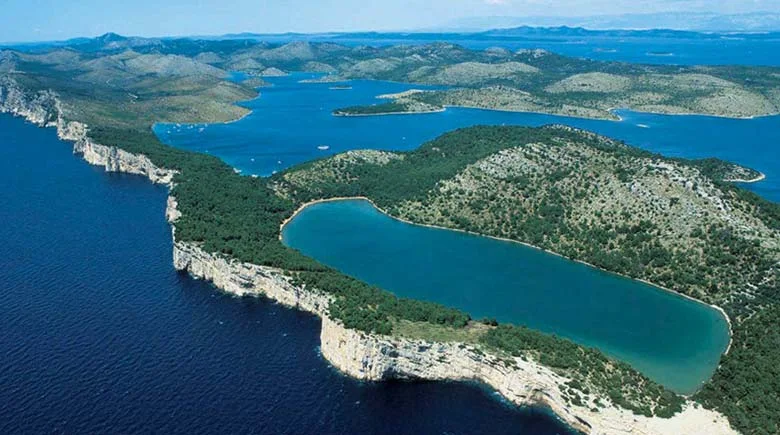
The Kornati National Park is the largest part of the Kornati island in the Croatian part of the Adriatic in Central Dalmatia, west of Sibenik, in Sibenik-Knin County. The national park was proclaimed in 1980 and then protected. The total area of the park is about 220 km² and consists of 89 islands, islets and rocks.. From the surface of the park, only about 1/4 is the mainland, and the rest of the marine ecosystem. It has natural and cultural characteristics. The vertical cliffs of the "crown" of the Kornati Islands facing the open sea are the most popular feature of this park. They are also a habitat for rare species. The underwater world of Kornati reveals some other amazing stories. Kornati, the largest island with a total area of 32.44 km2, covers two thirds of the park's surface. Although the length of the island is 25.2 km, its width does not exceed 2.5 km.
 |
| Kornati National Park |
The Croatian National Park Kornati, which includes the Croatian archipelago, consists of 109 islands of different sizes, 35 kilometers long. All the islands lie parallel from north to south. This region belongs to the densest part of the Mediterranean archipelago.
 |
| Kornati National Park |
The name of the largest island in the region is Kornat. There are no permanent residents in Kornati. Simple houses are available for temporary residence. Each island has its own magnificent bays. You can get to Kornati on your own by renting a boat.
 |
| Kornati National Park |
On some islands you can see steep slopes and hills. Some of them have historical ruins, among them the fortress of Tureta, which represents Byzantine architecture of the 6th century.
