 |
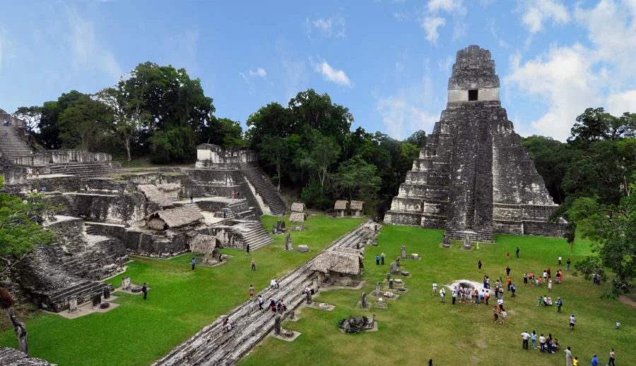
Tikal National Park is located in the Petén department in northern Guatemala; it was founded in May 1955 and covers an area of 57,583 hectares. In 1979, it was included in the UNESCO World Heritage List as a nature reserve and cultural protected site of the Mayan civilization, it is part of the biosphere reserves of the world.
 |
| Tikal National Park |
The main attraction of the Tikal National Park is the ancient Mayan city of Tikal, surrounded by the jungle. The national park is located on a limestone area, so the surface is poor in water, the climate is humid tropical, during the year the dry season is replaced by the rainy one, and the temperature ranges from 15 to 35 ° C. The reserve is covered with dense forest with crowns that rise up to fifty meters. The most common trees are ceiba, American cedar (fragrant zest), sapodilla, mahogany, rosewood and other valuable commercial species.
 |
| Tikal National Park |
Among the mammals that live in the Tikal National Park, the following stand out: the gray fox, jaguar, puma, ocelot, Mexican four-toed anteater, northern tapir, howler monkeys, bakers, armadillos and bats can be found. Tikal National Park is home to a huge variety of birds. It is home to the South American harpy, goggle-eyed turkey, falcon, spotted quail and many parrots, toucans, herons, various types of hummingbirds. Amphibians also get along comfortably in the vastness of the reserve. There are 19 species of frogs, five species of turtles, 24 species of lizards, 41 species of snakes (among them there are poisonous ones), salamanders and crocodiles - American and Morelet.
 |
| Tikal National Park |
The Tikal archaeological site covers 1,600 hectares in the heart of the Tikal National Park. It is the largest of the ancient Mayan cities of the classical period. One of the main cultural and demographic centers of the Mayan civilization flourished from 200 to 850 AD. Later, some of the palaces were burned down, and the population gradually declined until the site was empty at the end of the 10th century. According to archaeologists, the city of Tikal was a ceremonial center where ceremonies were performed to obtain a good harvest.
 |
| Tikal National Park |
The central floors of the acropolis housed family homes, steam baths, playgrounds, shopping areas and canals. Scientists estimate that Tikal had between 100,000 and 150,000 inhabitants. Six large pyramidal temples and a royal palace, as well as several smaller pyramids, palaces, have survived to this day.
For tourists there are regular transfers from the cities of Flores and Guatemala City, closest to the reserve.
